This is part of a short series of posts I wrote about a July 2017 road trip from Inverness northwards along the east coast of the Highlands, culminating in a visit to the abandoned island of Stroma. See all my posts on the overview page.
I first heard of Stroma, a small abandoned island between the Scottish mainland and Orkney, a couple of years ago through conversations on Twitter. Coming from the Western Isles, my knowledge of that part of the world is poor and my assumption had been that – apart from Orkney and Shetland – all Scotland’s notable islands are on the west coast. Moreover, when it came to depopulated islands, St Kilda is the most famous story of an island far from anywhere else, and I wasn’t really aware of any other significant examples.
But no, lurking in the choppy waters of the Pentland Firth lie a handful of long depopulated islands, and Stroma is one. Folk I chatted to on Twitter were so informative about this topic that I put all the tweets together in a Wakelet story. Read it here – there are some fascinating bits of information.
Stroma remained at the back of my mind until recently, when I got talking with a couple of Twitter contacts, broadcaster and adventurer Calum MacLean (quoted in that Wakelet story above) and historical researcher Linda Ross, about the island. An idle chat about how fun it would be to go suddenly turned into a decision to try to do exactly that, and… this past weekend we and a small group of other intrepid “stromads” made it over for a day trip.
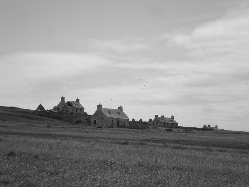
Sitting just a couple of miles or so off the coast of Caithness, Stroma is accessible from the harbour at Gill’s Bay, one of the ports from which you can sail to Orkney. The low-lying island is about two miles by one in size, but packed with evidence of its compelling recent past. At its peak the population was over 300, but all that remains today are ruined houses, several hundred sheep, and lots and lots of wildlife.
For some background before I go on with my account of my visit, check out the surprisingly detailed Wikipedia entry for Stroma, and also this beautiful map of the island that includes some fascinating annotations.
And it’s worth noting that, as somewhere lying relatively close to the Scottish mainland, Stroma is becoming increasingly well known as an example of a depopulated island. There was an interesting article published by the Scotsman just last month featuring photos by Caithness journalist Alan Hendry (who is well worth a follow on Twitter), and he’s also written a lovely piece on his recent visit in the Inverness Courier. And coincidentally as I write this, BBC News has just published an article about a visit by Highlands-based band Neon Waltz to the island (the beautiful music video they made of their visit is here).
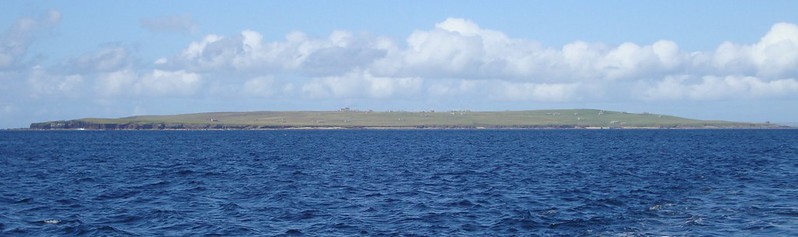
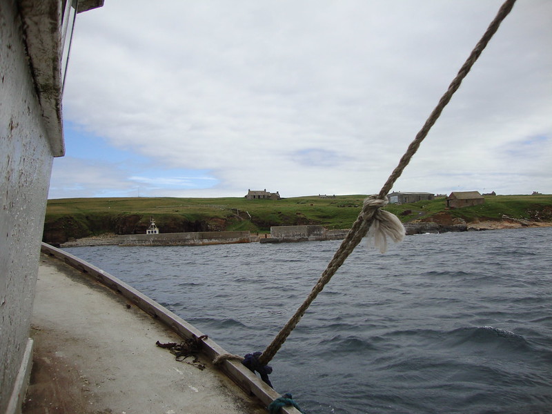
It was only a twenty minute journey over from Gill’s Bay to Stroma, but a bumpy one. Our boat, owned and crewed by Willie Simpson, the island’s owner, was small, and felt every undulation in the sea. For a poor sailor like me it was nerve-wracking, and only my focussing on the island ahead – perfectly visible from Gill’s Bay – helped to keep my legs steady.
A couple of things struck me as we landed on the island. And I mean, in the first instance, literally struck me. When we landed, we were greeted by a welcoming committee of fiercely territorial seabirds, including gulls and skuas, who had no fear in diving and swooping to try to dissuade our progress up the hill from the harbour. They’ve been known to draw blood from previous visitors. A hat, plus a stick if you can find one lying around, are recommended.
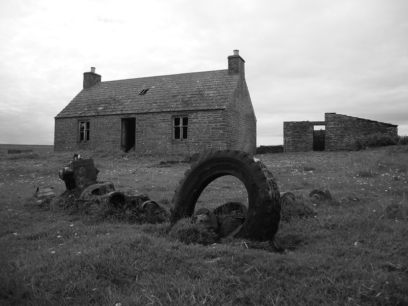
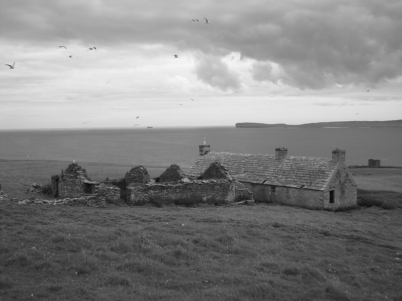
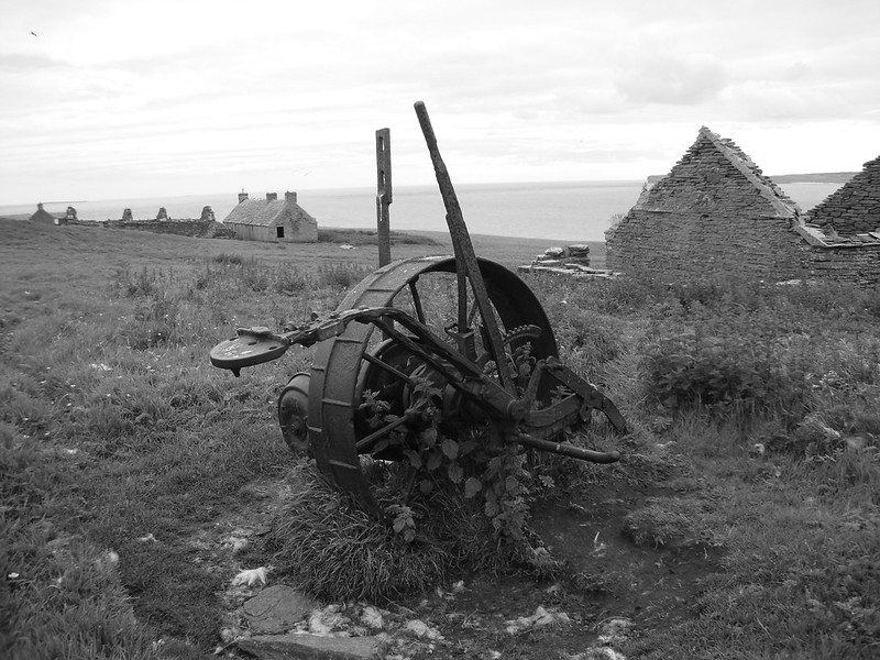
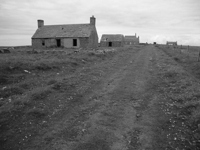
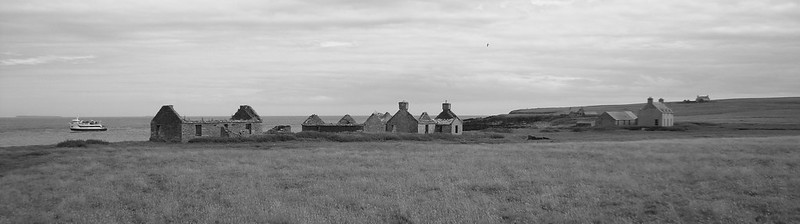
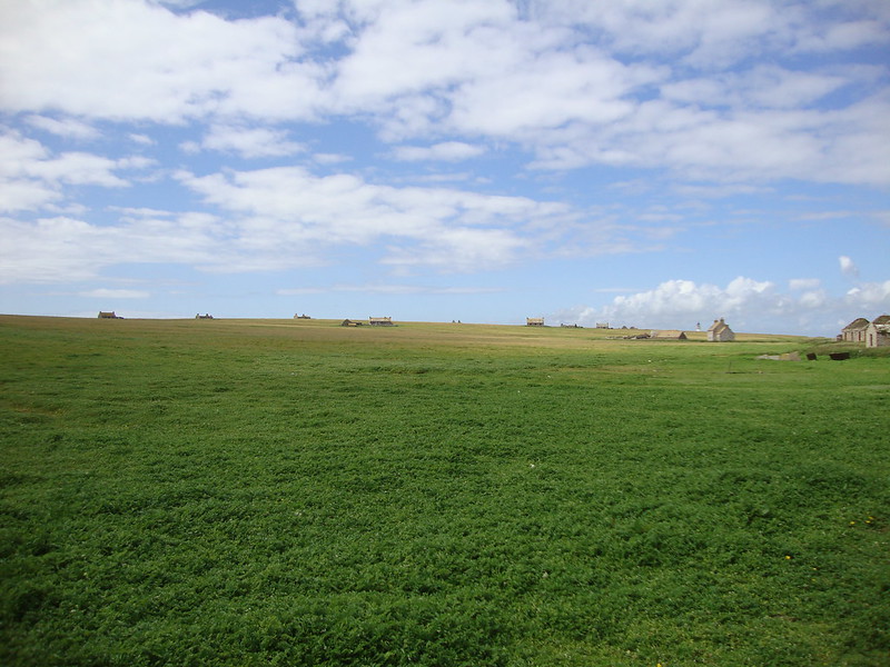
The second thing of immediate note was the enormous number of houses. As I say, the island’s population was over 300 at its early 20th century peak and there must have been, by a crude count, over twenty properties in varying states of decay, but most with sufficient structural integrity to gingerly enter. It is strange to think that an island so full and so bustling (by the standards of many Scottish islands) is now, within almost living memory of its highest population, left to the wind and wildlife.
Such was the size of the population that Stroma actually boasted two distinct villages – Uppertown, just up the hill from the harbour, and Nethertown, roughly in the centre of the island. If you check out the island on Google Maps you get a good lay of the land, its villages and other features in incredibly good detail.
The crumbling stone houses of Uppertown, silent and abandoned apart from swooping birds, faced south back across the water to the coast of Caithness.
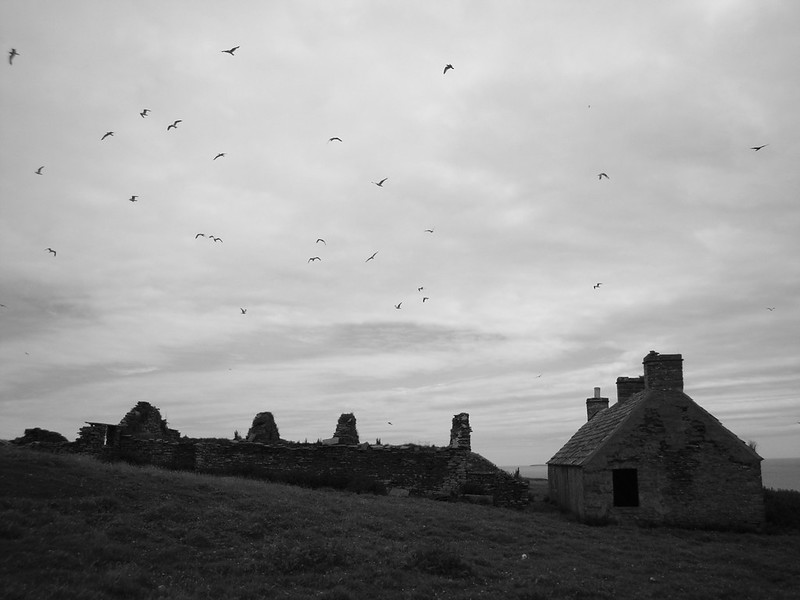
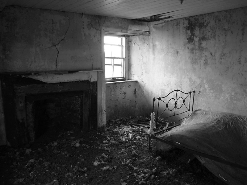
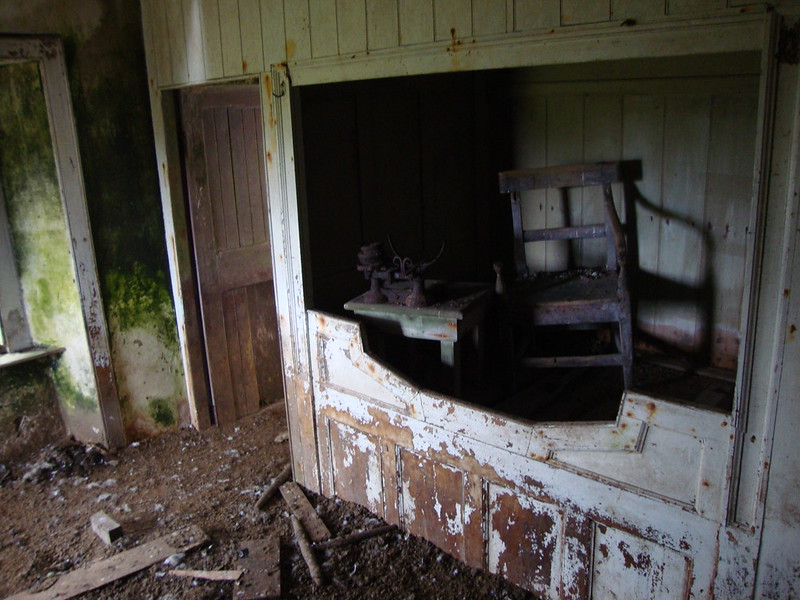
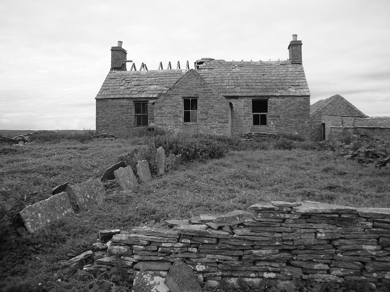
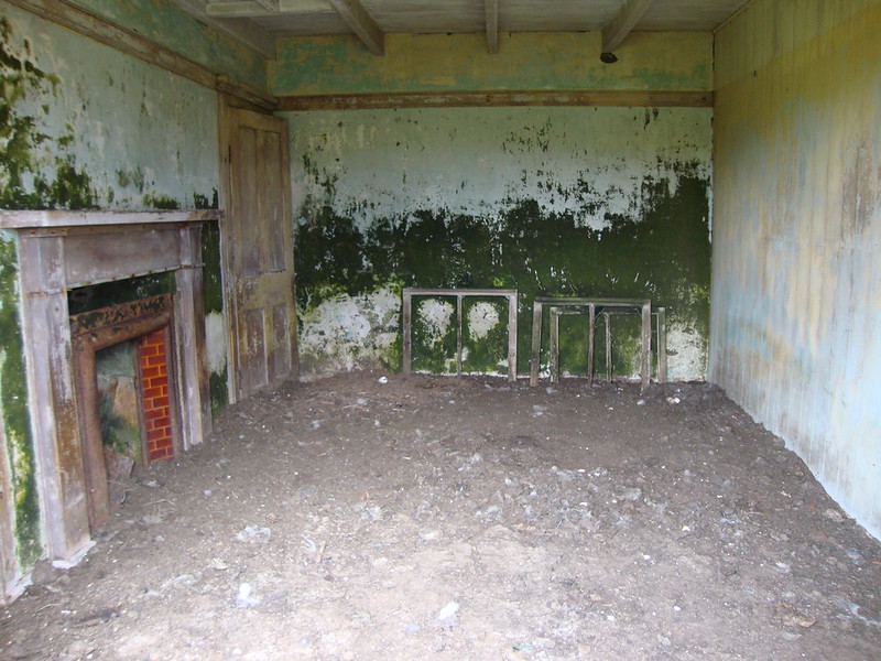
Those with roofs still intact exuded an eerie atmosphere, their interiors littered with presumably many years of bird droppings and the occasional disintegrating piece of furniture.
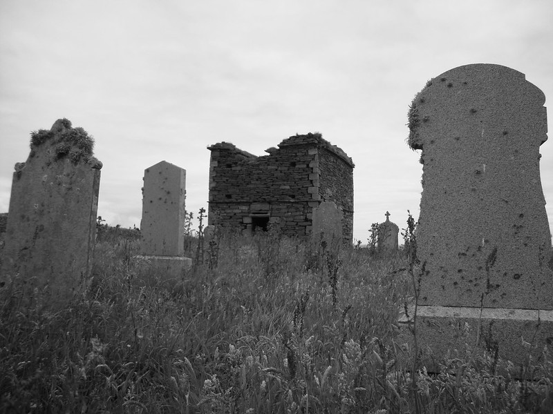
Uppertown also overlooked a striking mausoleum built, according to Wikipedia, in the 17th century and home once upon a time to mummified remains perfectly preserved by the salt air. Standing on a dramatic rocky outcrop overlooking the mainland, the mausoleum’s graveyard contained some quite recent headstones, presumably of those who once lived here and returned in death.
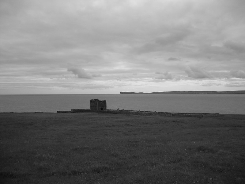
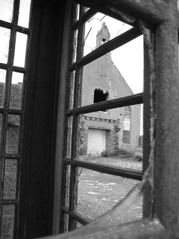
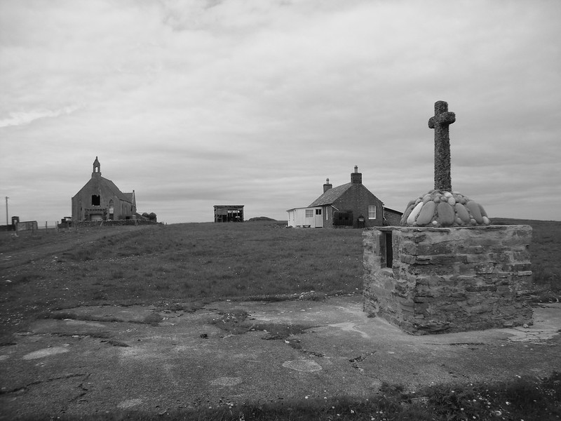
Over the gentle incline as we headed north from Uppertown lay another cluster of buildings. These included the school and the church. Or at least, one of the churches. There were, surprisingly, two churches on Stroma once upon a time. The Church of Scotland was the one still standing, a fairly modern building in the typical Highland style.
According to the map I linked to earlier a Baptist chapel lay in the southeast of the island somewhere near the mausoleum, though there was no obvious current sign of its remains. Going further back in history there were two older churches on the island, as outlined in this part of Stroma’s Wikipedia entry, though again there was no trace of them to be found.
The church was locked up, but the door opened enough to allow a blind (and in my case rather wobbly) shot of the interior, which seemed to have become a sanctuary to various detritus over the years.
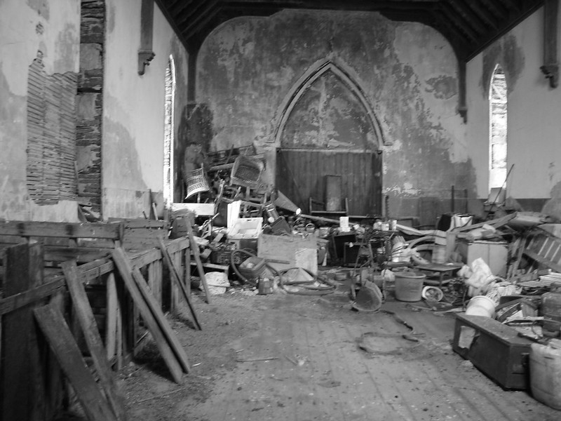
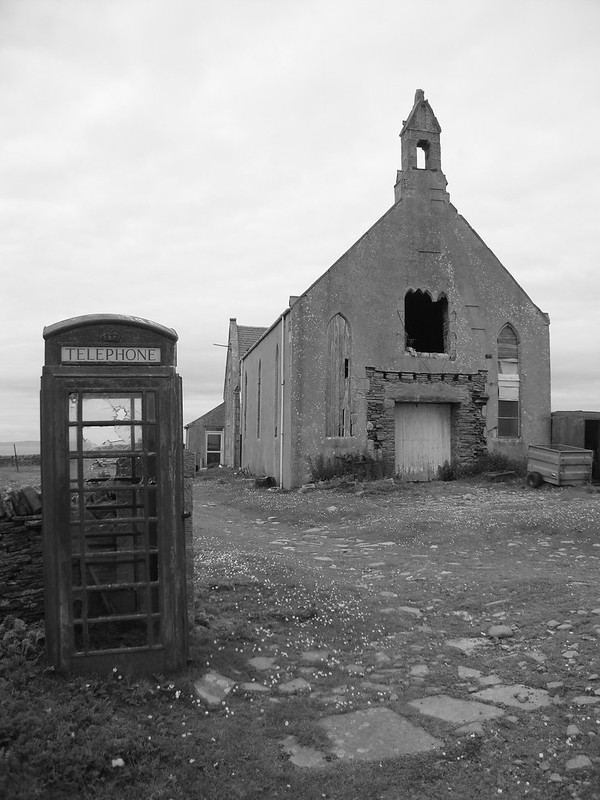 And yes, by the way, that is indeed a phone box next to the church. It is curious that while water and electricity mains never reached the island, a telephone line did.
The manse and one other nearby cottage seemed to be the only habitable houses on the island, kitted out for the owners’ visits to the sheep.
Near the church also stood the island’s modest but well-kept war memorial. Twelve names were listed. That so many died in the two world wars from a relatively small population was a reminder of the impact the wars have had in the Highlands and Islands.
These were often socially and economically fragile communities that could not afford to lose so many young men but yet which suffered devastating losses. For early twentieth century Stroma, where the population was already falling, the war losses would surely have been a factor in the decline of a viable workforce and the acceleration of the island’s further depopulation.
Heading north again, we passed the Mains of Stroma, a large collection of farm buildings which rested in the midst of the fenced-in farm land, the abandonment contrasting with the freshly sheared sheep who grazed the fields. The island’s main “highway” was in reasonable condition, given the owners’ need to visit to attend the sheep.
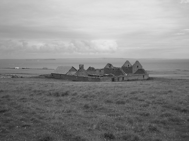
On the other side of the road was what was left of the island’s other village, Nethertown. As with Uppertown, houses were in various states of decay.
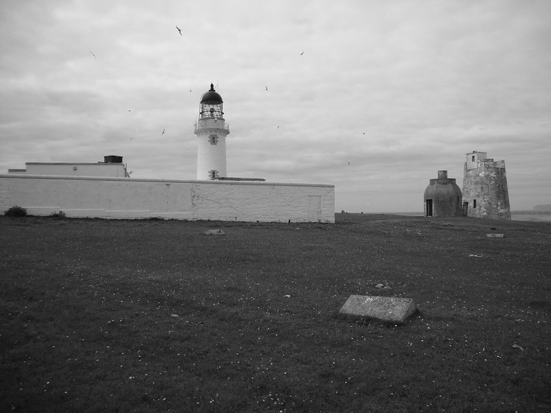
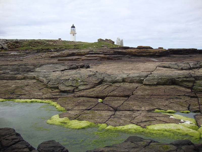
At the top of Stroma, the southernmost islands of Orkney visible on the horizon, stood the lighthouse. Built at the end of the 19th century, it was only automated in 1997 and was now, like much of the rest of the island, a Hitchcockian danger zone with shrieking gulls fervently patrolling their domain.
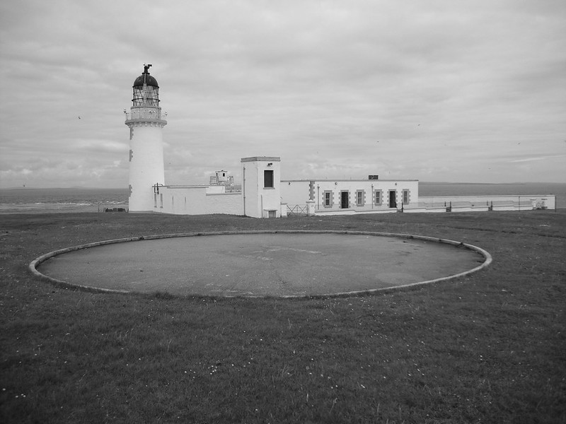
Heading down to the shore from the lighthouse, you could get a sense of what an exposed spot this must be and, given the terrain, how difficult it must have been to get supplies to it by boat.
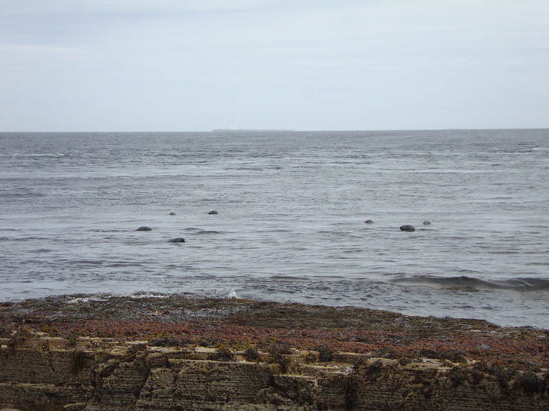
It was also one of the many opportunities to see the numerous seals living round the island. And in the photo below you can also see the Orkney island of Muckle Skerry and its lighthouse in the distance.
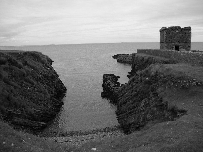
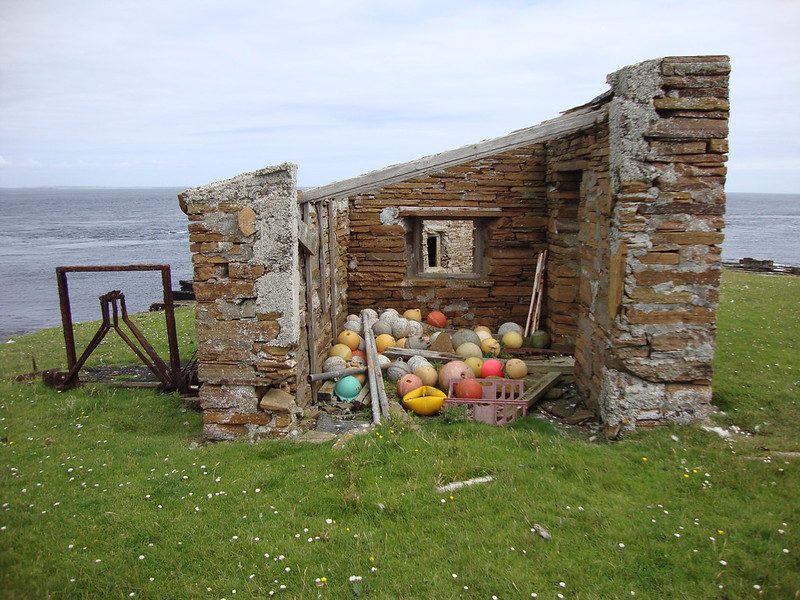
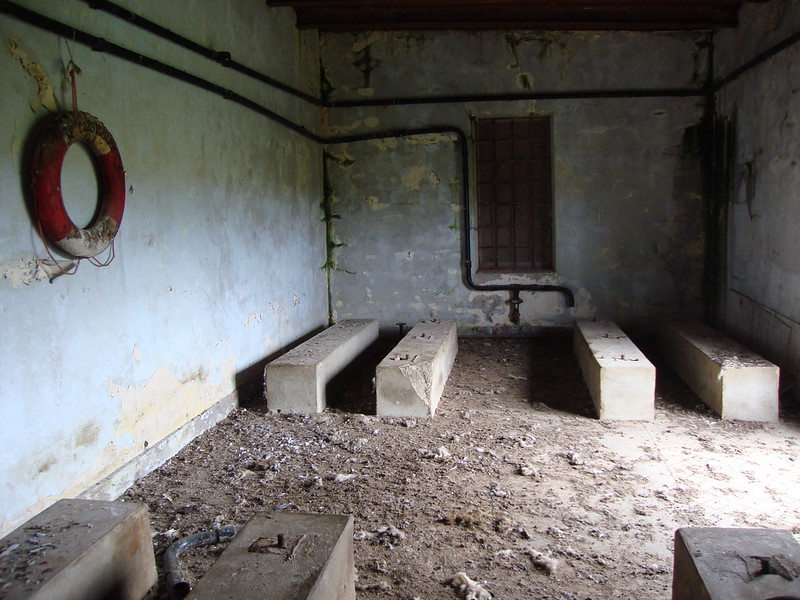
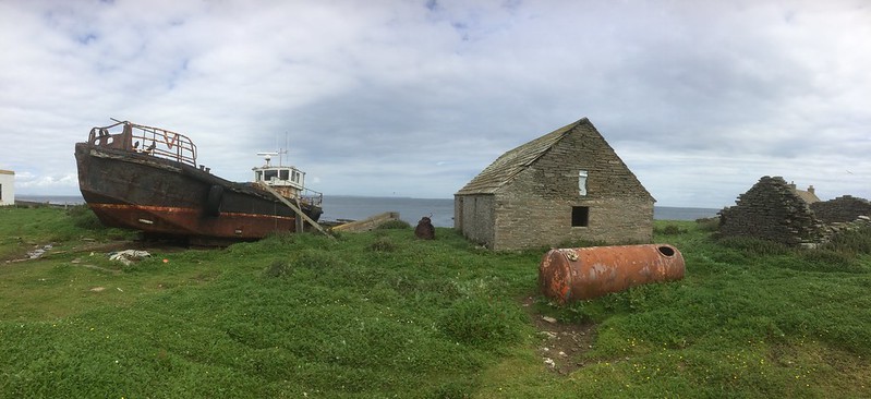
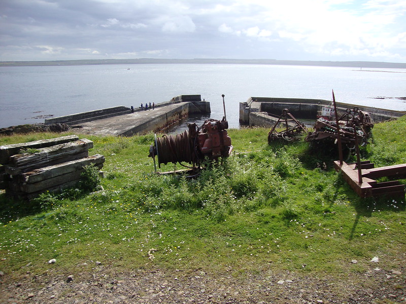
From the lighthouse, we headed down the eastern side of the island, where we had earlier seen an older harbour, slipway and some more houses. The scene was dominated by a rusting hulk of a boat, what appeared to be a coastguard station, and what seemed to be the only two storey houses on the island outside the farm houses.
From my photos and description thus far, it may seem that the visit was all about the human habitation of the island. And that really does come over strongly, this being an island that lost its last permanent inhabitants only fifty years ago, their impact still lingering among the crumbling stones and rusting machinery.
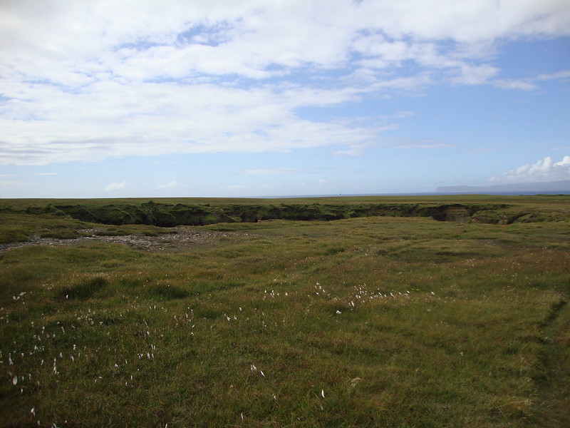
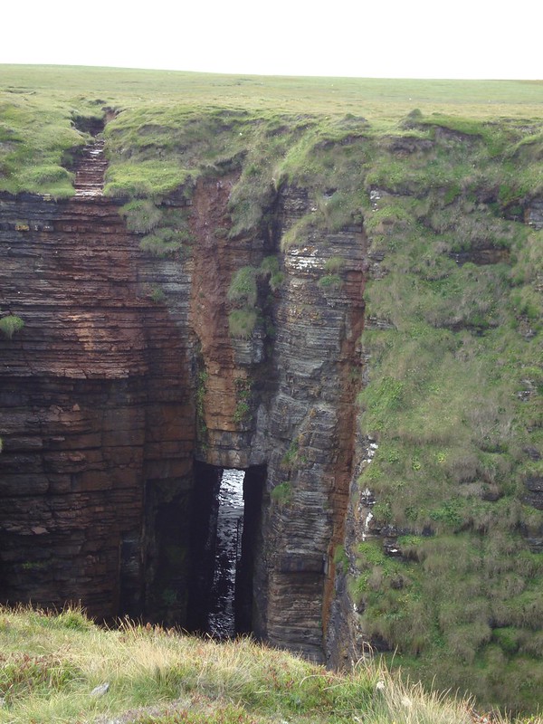
But Stroma’s natural wonders – from birds to flowers – are numerous, and geologically the island is of interest too. As you can see clearly on Google Maps, the island is split between rough moorland on the western half and more cultivated land on the east, and the most dramatic feature on that western side was the Gloop.
I saw the Gloop as the final highlight of our five or so hours on the island before we headed back to the boat. The Gloop was a giant hole in the ground not far from the shore and linked to the sea by a tunnel. It was a stomach churning scene, with a huge drop down the exposed cliffs to the sea below, and you can imagine that on occasions waves will crash upwards through the Gloop – though that kind of day would be one where sailing to Stroma to experience it would be impossible.
Walking back south from the Gloop, the sun fully came out, bathing the island in a welcome warmth, and turning the grass a brilliant, lush green. It was a reminder, as we headed to the harbour for our return boat, of what a beautiful place Stroma could be, at least on those few good summer’s days.
All too soon, our time on Stroma was at an end, and we headed back down to the harbour, fighting off the diving birds for a second time, just as the boat pulled in to collect us.
The way back – a thankfully smoother crossing than the outbound journey – was a chance to chat a bit to Willie, the owner, about the island. His father had been born on Stroma, but moved to the mainland for school. Although there was a primary school on Stroma, secondary education was in Wick and this robbed families of an extra pair of hands for the croft.
Albeit that crofting and fishing was no basis for thriving. It was hard to sustain in such a small place when the elements were so fierce. Hence, explained Willie, incomes had often been supplemented in the past by piracy – with fine vantage points in all directions and a community of necessarily skilled seafarers, passing cargo was rich pickings.
But obviously that, and the fine modern harbour we sailed back from, was not enough to keep the population from being unsustainable in the long term. And now Willie uses it for his sheep, and he visits to tend to them and to take occasional day trippers like ourselves who are able to find him. I commented that there was so much to see on the island that it could easily fill a couple of days’ exploration – did he permit overnight stays? He did not, he said, for the principal reason that when he’d once allowed a group to stay over, he’d ended up with a telephone call (there is surprisingly good mobile phone signal on Stroma) from people wanting to get off early. Clearly the island is not for everyone, and emergency runs backwards and forwards were not an efficient use of his time or boat.
There is clearly no prospect of Stroma becoming a major tourist destination. Tours are neither regular nor advertised, being run only on occasional days when Willie has contact from enough people to make it viable – and even then trips can be cancelled at short notice if the weather is bad.
And after all, it is a working sheep station, and is home to nesting birds and much other wildlife. To increase visitor numbers significantly would be to threaten that. Given it’s not easy to get there as it stands, it also means that it’s visited only by folk with some initiative and an interest in wild or abandoned places who probably know how to conduct themselves in such a location. With higher numbers would surely come higher chances of people causing damage or getting into difficulty.
As it was, we were seemingly trusted, left on the island that morning with not a word of instruction, restriction or warning – except the hour of our return sail.
Stroma remains, then, a curious contrast between its wildness and its proximity. It is obviously abandoned and depopulated, home to no permanent residents, yet it is almost on the doorstep of both mainland Caithness and Orkney – easily visible, passed regularly and closely by ferries and cargo vessels, and a short sail away.
In some senses, it’s amazing to think that the island was allowed to decline the way it did. At its peak its over 300 inhabitants represented what should be the core of a sustainable community. Indeed by my rough calculation, it would have had at its highest population around 100 people per square kilometre, which if it were the case today would (according to this page on Wikipedia) make it one of the most densely populated islands in Scotland. And while it was in an exposed location, communities exist in much more challenging and much more isolated climes, even in Scotland.
I couldn’t help thinking that if this was a Scandinavian island it would be a strong and thriving place – somewhere invested in, supported, and nurtured as a legitimate settlement. Who knows, someone might even have proposed a bridge or tunnel to provide a fixed link.
As I’ve mentioned already, there was a good harbour built in the 1950s and the island – although never enjoying mains electricity or water – was eventually connected to the telephone network. But like so many of the interventions, it was too little too late. It seems that what to do with Stroma was a matter of much head scratching and very little effective decision making from the local authorities. Linda, who was a part of my group, dug up some fascinating old articles in preparation for the trip that reported on the various whacky and increasingly desperate ideas that had been knocked around, none of them ever implemented (in some cases perhaps thankfully so).
https://twitter.com/linda83ross/status/883612417141481472
As it was, the island suffered on two fronts from poor local government support and the harsh environmental conditions. It is, after all, low lying, in one of the most notoriously rough stretches of water, and with a history of being cut off often for weeks at a time.
It stands for me therefore as an example of, and monument to, the poor way Scotland’s islands and rural communities in general have been supported. Perhaps it’s a lesson. After all, the last people left not so long ago, and the modern houses they left behind are eerily alike many that are inhabited on the mainland today, and there are fragile communities across the Highlands and Islands.
It’s not hard to imagine Stroma’s state of abandonment being what many other places will look like if we do not ensure their survival.
See all my photos from Stroma, and the wider trip I took that weekend, on Flickr.
There are links below to photos and videos made by others in our group. Do take a look.


hi.
Great read, i’m most interested in a visit to Stroma, may you help me with some contact details etc.
im visiting north Scotland around 24th May 2022 for a few days
many many thanks
Hi Ja-San, I hope you make it and enjoy your trip. Not much to help you with in terms of contacts, except to say that you should ask for Willie’s details from the John O’Groats tourist information centre: https://www.visitjohnogroats.com/information/tourist-office/
Thank you Simon…
i’ll update you if i’m successful.
i appreciate your reply.
keep safe